Lincoln Highway Illinois
Communities
The map below shows the first generation and subsequent second and third generation communities of the Lincoln Highway in Illinois, which adventurers can still visit today. The "Coast To Coast Rock Highway" took travelers past and present through town and countryside, up and down the rolling hills of the prairie, around curves, across creeks, rivers, ditches, and canals, and over, under, and alongside railroad tracks. Today, you can follow the original Lincoln Highway alignment, visiting nearly 40 communities along the way that helped to build the route through Illinois, making it the first state to complete its portion of the highway in its entirety. On the map below, communities along the original (first generation) Lincoln Highway routes are denoted in light blue. In contrast, communities later included during the second and third generation realignments are marked in a darker blue. As municipal annexations continued in suburban areas during the latter quarter of the twentieth century, new communities, such as Mokena and Oswego, shared boundaries with the historic route. The map below focuses solely on the communities traversed by the Lincoln Highway during its historic period (1913-1967).
Learn more about each community by clicking on each point for additional information. It's interactive!
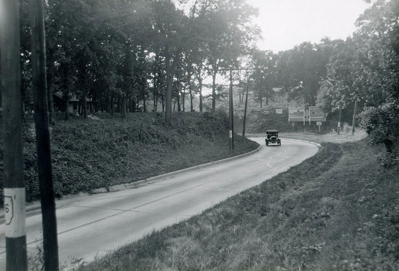
View of the completed Lincoln Highway between Morrison and Fulton, Illinois, 1926.
Courtesy of the University of Michigan Library.

Plan Your Trip
Use the filter below to explore points of interest along the Lincoln Highway in Illinois.
Arche Fountain in Alex Lopez Park
SW corner of Lincoln Highway and Dixie HighwaysChicago Heights , IL 60411
Benton Street and Downers Place Bridges over the Fox River
Benton Street and Downers Places over the Fox RiverAurora, IL 60506
Crossroads of the Nation
Intersection of Lincoln Highway and Dixie HighwayChicago Heights , IL 60411
LaSalle Street Auto Row Historic District
LaSalle Street between Downer Place and Benton StreetAurora, IL 60506
Lincoln Highway Gazebo - Batavia
Lincoln Highway between WIlson and Howard StreetsBatavia , IL 60510
Lincoln Highway Mural #2 - Rochelle
IL Route 38 just south of 151 N. 15th Street and the railroad tracksRocehlle, IL 61068
Lyons and Fulton Bridge
Mississippi River immediately aligned with the De Immigrant WindmillFulton, IL 61252
Site of Joliet-Plainfield Plank Road Toll Gate
NW and SE corners of US Route 30 and Raynor/Black RoadJoliet, IL 60435
Soldiers Monument at Veterans Mound
NW corner Lincoln HWY and Chicago RoadChicago Heights , IL 60411
Texaco Service Station
SW corner of Des Plaines Street and Lockport Street (Lincoln Highway)Plainfield , IL 60544
Traveling the Plank Road Sculpture
NE Corner of Ingalls Avenue and U.S. Route 30 (Lincoln Highway)Joliet, IL 60435
Heritage Corridor Destinations
701 Essington Road, Suite 100 Joliet, IL 60435 (844) 94-HCCVB (844-944-2282)
701 Essington Road, Suite 100 Joliet, IL 60435 (844) 94-HCCVB (844-944-2282)

References Credits and Acknowledgements Accessibility Statement
© 2026 Heritage Corridor Destinations and Illinois Department of Transportation / Bureau of Planning Grant Award. All rights reserved. Design and Development by J Rudny, LLC.